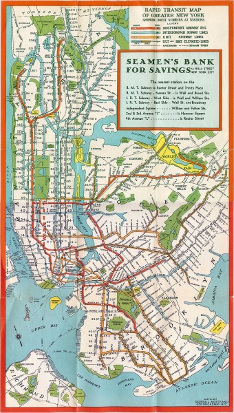
I found this map at the website www.mappery.com. Simply put, the website is a massive database filled with thousands of different "real life" maps. All of these maps either existed at one time, or are still accurate and in use today. This is a map of the New York City Subway system in 1930. The map shows all of the various subway lines that travel through not only Manhattan, but also the other four boroughs. It has different color codes for the different subway lines. However, not only does it show the subway lines, it also shows the geography of New York City. All of the rivers and parks throughout the city are all labeled clearly. What I find especially interesting about this map is its age. Even though it was created during the 1930s, it looks as though it could be a current map. Also, similar to all other transit maps, I find the various colors and designs of the transit system fascinating. The map perfectly captures the grid system of Manhattan.
Los Angeles From Above
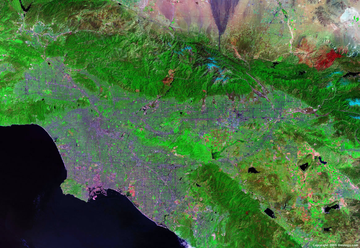
This map was found at www.geology.com, a website filled with detailed information regarding Earth science and geography. The website also contains several maps of various geographic interest. This Landsat image provides the viewer with an aerial view of the Los Angeles Basin. Not only does it show the terrain, such as the hills, mountains, valleys, and oceans, it also provides a detailed map of the streets and metropolitan regions. What I find particularly interesting about this map is the intricate detail it provides. It is possible to trace the highways and clearly recognize the massive grid that Los Angeles was constructed upon.
The Literary City

This map was found at www.TheHarperStudio.com, an arts and entertainment blog. In this map, artist Ian Huebert uses famous literary quotes to divide the city of San Francisco into its unique districts. While the map may not be incredibly accurate, it still offers the viewer a clear view of the city from above. With any knowledge of the city, it is clear where one district begins and the other ends. What I find particularly interesting about this map are, first of all, the many colors, and second, the overall creativity. Huebert proves that maps can be a work of art, as well as a necessary tool for direction and movement.

Very nice maps, layout and descriptions. My only comment would be to include links to the pages on which the images are hosted so I can easily find them.
ReplyDeleteGrade: 9.5